Nautical Twilight: Definition, Times, and Why It Still Matters
The twilight window when the horizon and the brightest stars can be visible together — and the reason sailors built a navigation method around it.
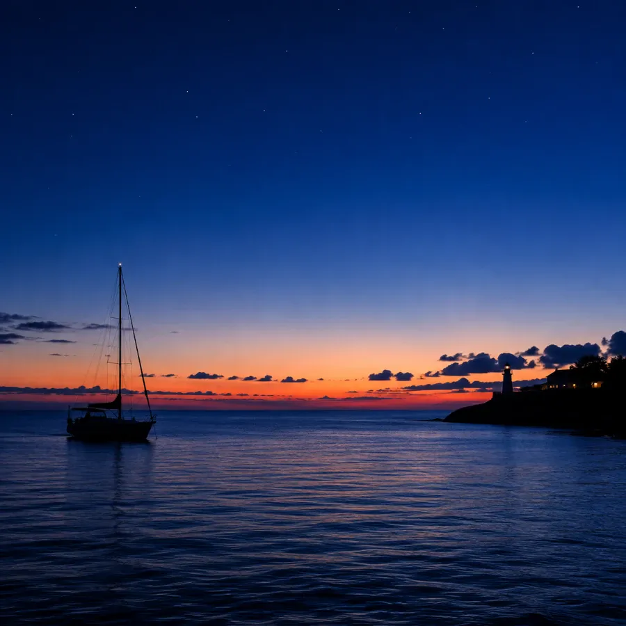
Nautical twilight is the interval when the sun sits between 6° and 12° below the horizon. It begins where civil twilight ends and runs until the sun's center reaches 12° below the horizon. It happens twice a day, at dawn and dusk, sitting between civil twilight (brighter) and astronomical twilight (darker). Under clear conditions the horizon is typically still faintly visible for most of this window, while the brightest stars appear. That's the combination sailors historically relied on to fix their position at sea with a sextant.
The Three Twilights, Compared
Twilight isn't one phase — astronomers split it into three stages, defined entirely by how many degrees the sun sits below the horizon. Each stage has a different practical meaning.
| Stage | Sun angle | What's visible |
|---|---|---|
| Civil twilight | 0° to −6° | Enough light for most outdoor activity without artificial lighting; brightest planets may appear |
| Nautical twilight | −6° to −12° | Horizon still visible under good conditions early on, fading by the end; brightest stars become prominent |
| Astronomical twilight | −12° to −18° | Sky approaches full darkness; horizon no longer discernible; fainter stars increasingly visible |
Duration is deliberately left off this table because it isn't fixed. It depends heavily on latitude, season, and date — the sections below cover that with concrete examples rather than one universal number.
These boundaries follow standardized astronomical conventions for the sun's depression below the horizon. They correspond broadly to practical, useful changes in illumination and visibility, rather than to one precise physiological threshold. Civil twilight's boundary lines up roughly with the point when ordinary outdoor activity gets difficult without artificial light. Nautical twilight's boundary lines up with when the sea horizon typically becomes too indistinct to use as a navigation reference. Astronomical twilight's boundary lines up with when the sun's residual glow stops meaningfully affecting the visibility of faint stars.
Why "Nautical"? The Historical Definition
Nautical twilight is one of the few widely-used astronomical terms named directly for how a profession used it. For centuries, this window was when a ship's navigator could take a reliable star sighting.
Celestial navigation works by measuring the angle between a star and the horizon with a sextant. Navigators then use that angle to calculate position. The method depends on a tradeoff. Earlier in twilight the horizon is easy to see but stars are still hard to pick out. Later on, stars become plentiful but the horizon fades.
Nautical twilight is the conventional window where that balance tends to work for a star sight. That's why navigators historically took their sightings during this period, both at dawn and dusk. Doing so let them fix a ship's position before setting a course for the day or night ahead.
Before nautical twilight had a name
For much of the age of sail, ships navigated primarily by dead reckoning — tracking speed, heading, and elapsed time from a known starting point. It worked, but errors compounded with every hour at sea. A small mistake in estimated speed on day one could put a ship miles off course by day twenty. There was no way to check the math until land, or disaster, appeared.
Celestial navigation offered a correction. By the 18th century, navigators could combine a sextant sighting with an accurate marine chronometer to calculate latitude and, crucially, longitude. The chronometer itself was a hard-won invention — keeping precise time on a rolling, humid, temperature-swinging ship had defeated clockmakers for decades. The method relied on the same brief daily windows that later formalized into nautical twilight.
Taking a star fix
A single star sighting only tells a navigator they're somewhere along one line on the chart — not a fixed point. A common approach, still taught today, is to sight several stars spread widely around the sky, ideally with good separation in azimuth. Each one gives its own line of position. Where those lines cross, or form a small triangle, is the ship's estimated position. The exact number of stars and how they're chosen varies with the navigator, the conditions, and which bodies are available.
Accurate timing matters a great deal in this process. At the equator, a timing error of about four seconds translates to roughly a nautical mile of position error, since the Earth rotates 15° of longitude per hour. Away from the equator, and depending on the geometry of the sighting, that relationship shifts. But the underlying point held for centuries of navigators: an excellent sextant reading paired with a poor clock was nearly worthless.
This is also part of why nautical twilight, rather than full darkness, was the preferred window — even once electric lighting made night sightings technically feasible. For a conventional sea-horizon sight, the sextant needs a visible horizon as its reference. Methods using an artificial horizon exist, but the standard technique relies on the real one.
From sextants to satellites
Celestial navigation stayed a primary method of open-ocean positioning well into the 20th century. GPS didn't take over general maritime use until the 1990s. Along the way it also picked up a military shorthand still in use today. BMNT and EENT are short for "begin morning nautical twilight" and "end evening nautical twilight." The U.S. military uses these terms in tactical planning around the natural light available at those hours.
Some maritime and naval programs still teach celestial navigation today, not out of tradition alone. It needs no satellite signal that jamming, spoofing, or an outage can knock out. Nautical twilight remains the operative window for it, for the same optical reason it always was.
How Nautical Twilight Is Calculated
The boundaries of nautical twilight are defined purely by geometry: the angle between the sun's center and the horizon, measured along a vertical circle. When that angle reaches 6° below the horizon, nautical twilight begins; at 12° below, it ends and astronomical twilight takes over.
That sun angle has two names. It's called the solar elevation angle when positive, and the solar depression angle once the sun drops below the horizon. Three inputs determine it: the observer's latitude, the sun's declination, and the local hour angle. Declination is the sun's position relative to the celestial equator, which changes through the year. Local hour angle is essentially what time of day it is relative to solar noon. Full-precision almanacs solve this with spherical trigonometry. The short version: it's the same math used to determine sunrise and sunset, just evaluated at −6° and −12° instead of 0°.
A worked example
Take a location at 40°N latitude in early spring. Civil dusk — sunset plus roughly 20 minutes — arrives first, as the sun crosses 6° below the horizon. Nautical dusk follows about 25 to 30 minutes later, once the sun reaches 12° below. Astronomical dusk, and true night, arrives another 30-odd minutes after that. The exact minute count shifts with the date, because the sun's path relative to the horizon isn't constant. It's steepest at the equinoxes and shallowest near the solstices at that latitude.
What shifts the timing
Three factors change how long nautical twilight lasts on a given day and where:
Latitude — near the equator, the sun drops almost straight down, so it crosses each 6° band quickly. Near the poles, the sun's path is much shallower relative to the horizon, so it can take hours to cross the same band.
Season — the sun's angle of descent changes through the year, which is why twilight duration shifts noticeably at higher latitudes but barely at all near the equator. This is also why the same city can have a 30-minute nautical twilight in January and a 50-minute one in June.
Atmospheric refraction — the atmosphere bends light slightly, and precise twilight calculations account for it. For ordinary twilight timing at moderate latitudes, its effect on the reported minute is small. Conditions and atmospheric variability can matter more at high latitudes, though, where the sun's path is shallow and small angular differences translate into much larger time differences.
Why elevation and haze matter too
The 6°/12°/18° boundaries describe an idealized flat horizon with a clear sky. In practice, actual usable light at nautical twilight depends on local conditions. Haze, cloud cover, humidity, and light pollution can all make the horizon disappear earlier than the calculated time suggests. They can also make the sky look darker than the sun's geometric position alone would imply. A calculated nautical twilight time is a reliable baseline — real-world visibility on any given evening can vary around it.
How Long It Lasts, by Latitude
Because the sun's path relative to the horizon changes with latitude, nautical twilight can last anywhere from twenty minutes to several hours — or not end at all.
When twilight stops having a clean end
Around 60° latitude in summer, the sun's midnight depression angle can stay under 6° all night. That's shallow enough that the sky never drops out of civil twilight before starting to brighten again. This is the "white nights" effect associated with cities like St. Petersburg (roughly 60°N): the sky stays in a persistent dusk-like glow rather than cycling through nautical or astronomical twilight at all.
Go further toward the poles and a different version of the same effect shows up in winter. The sun's midday elevation stays low enough, or negative enough, that a location can remain within the nautical twilight band for the entire day. That band runs from 6° to 12° below the horizon. There's no true sunrise or sunset. This is sometimes called "nautical polar night." Ny-Ålesund, Svalbard, at roughly 79°N, experiences it for about two and a half weeks in December. A comparable stretch happens again in early summer at its antipodal point.
In both cases, nautical twilight itself doesn't vanish. The sun simply stops crossing the boundaries that would normally divide the day into distinct twilight stages. One stage can dominate for days or weeks at a time as a result.
Why duration isn't symmetric with day length
A common assumption is that longer days simply mean longer twilights, but the relationship isn't linear. Twilight duration depends on the angle at which the sun crosses the horizon, not how long it stays up. At many mid- and low-latitude locations, twilight is shortest around the equinoxes. That's because the sun's daily path tends to cross the horizon at a comparatively steep angle for that latitude. Day and night are roughly equal length at that time, even so. High-latitude behavior departs from this pattern in the ways described above.
How to Read Nautical Twilight Times for Your Location
Timing depends on exact latitude, longitude, and date. A dedicated sun-times calculator is the most reliable way to get nautical twilight times — better than a rule of thumb. Enter your location and date, and look for two nautical entries per day: one before sunrise (nautical dawn) and one after sunset (nautical dusk).
Tables typically list civil, nautical, and astronomical times together, in that order, moving from lightest to darkest. Nautical twilight is usually the second pair of times on the page.
Who Uses Nautical Twilight Today
GPS replaced celestial navigation as the primary method decades ago. Even so, several groups still track nautical twilight, plan around it, and in some cases reference it legally.
Navigation and operations
-
Maritime
Sailors and ship's officers in some maritime and naval training programs still learn celestial navigation as a non-electronic backup. Nautical twilight remains the practical window for taking manual star sights with a sextant when it's used. Requirements vary by country, vessel type, and role.
-
Aviation
Pilots and flight planners use published civil and nautical twilight times as reference points for lighting and visibility planning. The legal definition of "night" varies by country and type of operation, and isn't universally tied to nautical twilight specifically.
-
Operations
Search and rescue teams and military units plan around nautical twilight for natural concealment and minimum-visibility thresholds. The U.S. military formalizes this with BMNT and EENT, marking the start and end of morning and evening nautical twilight in tactical planning.
Everyday and scientific uses
-
Photography
Photographers shoot during this window for the deep, saturated blue sky it produces — commonly called "blue hour." It's a favorite for cityscapes and coastal scenes, where the sky's ambient light balances well against artificial lighting. Golden hour prizes warm directional light on a subject; blue hour prizes the sky itself.
-
Astronomy
Astronomers and stargazers use nautical twilight as a rough marker for when the brightest planets and stars become viewable, ahead of full astronomical darkness. Serious deep-sky observation waits for astronomical twilight to end, but nautical twilight is often when telescopes get set up and aligned.
-
Wildlife
Field biologists and outdoor recreationists pay attention to nautical and civil twilight because many species shift activity noticeably during these low-light windows. Some regional outdoor-activity regulations reference twilight boundaries too, though definitions vary by jurisdiction.
Nautical Twilight vs. "Blue Hour" — Are They the Same?
Close, but not exactly. Blue hour is an informal photography term, not an astronomical one. It has no fixed degree boundaries, and is generally used to describe the rich blue sky visible from late civil twilight through nautical twilight.
Nautical twilight is precisely defined: sun at 6° to 12° below the horizon, full stop. In practice, the two overlap heavily, which is why the terms get used interchangeably. A photographer's "blue hour" often starts a little earlier and ends a little later than the astronomical definition of nautical twilight.
Why the sky turns that particular blue
The color comes from a combination of atmospheric scattering and absorption once the sun has dropped below the horizon. Ozone absorption in particular plays a notable role in producing the deep blue, rather than the orange tones of daytime scattering. It reads differently on camera than the orange-dominant light of golden hour. Because it's dim and largely directionless, blue-hour images tend to lean on artificial light sources — windows, streetlights, skylines — for contrast rather than shadow and highlight.
Despite the name, "blue hour" rarely lasts a full hour. It's closer to the actual duration of nautical twilight itself, which as covered above varies with latitude and season but is often well under an hour.
Common Misconceptions
"Nautical twilight means it's fully dark"
Not quite. Nautical twilight is a transitional phase — it starts closer to daylight than to night, and only approaches full darkness near its end. The defining feature isn't overall darkness but the specific combination of a fading horizon and emerging bright stars.
"Twilight length is the same everywhere"
It varies enormously by latitude and season, as covered above. A short nautical twilight near the equator can stretch well past an hour at high latitudes in summer. Near the poles it behaves very differently still — the sun may not cross the relevant boundary at all for days or weeks at a time.
"Blue hour and nautical twilight are the same thing, precisely"
They overlap but aren't defined the same way — see the comparison above. Blue hour is a loose photographic convention; nautical twilight is a fixed 6°-to-12° astronomical band.
"You need a sextant to care about this"
Celestial navigation is the historical reason for the name. But the practical uses today span photography, aviation, astronomy, and outdoor recreation. None of them require a sextant — just an accurate twilight table for the right date and location.
Glossary of Related Terms
-
Term
Solar depression angle — how many degrees below the horizon the sun's center sits at a given moment. The value that directly defines all three twilight stages.
-
Term
Sextant — a handheld optical instrument that measures the angle between a celestial object and the horizon, historically the core tool of celestial navigation.
-
Term
Line of position — the line on a chart along which a ship must be located, derived from a single star sighting. Multiple lines of position, from different stars, are combined to fix an exact location.
-
Term
Dead reckoning — estimating current position using a previously known position plus known speed, heading, and elapsed time, without external reference points.
-
Term
Golden hour — the warm, low-angle light shortly after sunrise or before sunset, distinct from blue hour and occurring during daylight, not twilight.
-
Term
White nights — a summer phenomenon at high latitudes where the sky never grows fully dark because the sun's night-time depression angle never reaches 18°.
Frequently Asked Questions
Timing and duration
Visibility and definitions